Item 03 · Streets & public works · Legal
Handwritten Right-of-Way Descriptions for Highway N.R.M. No. 167 (Cook, Robertson, and Smith Properties)
c. 1934 · 3 pages
Synopsis
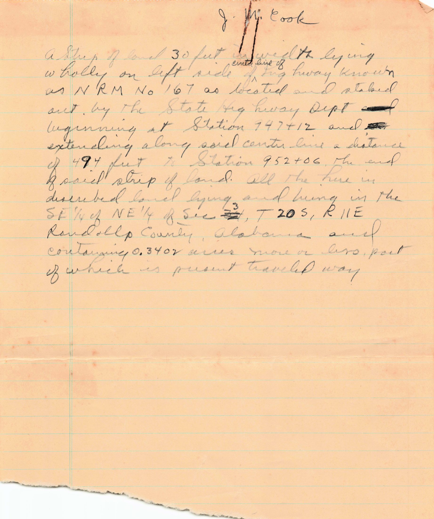
Three handwritten pencil drafts on lined paper describing strips of private land needed for the right of way of the highway known as N.R.M. No. 167, as staked out by the State Highway Department through Wedowee. Each sheet is headed with a property owner's name: J. M. Cook, Mrs. Nannie Robertson, and Mrs. B. H. Smith. The descriptions give the width of each strip (30 or 40 feet), which side of the center line it lies on, and the survey stations it runs between (for example, Station 947+12 to 952+06 for the Cook strip). Each strip lies in the SE 1/4 of NE 1/4 of Section 3, Township 20 South, Range 11 East, Randolph County, and its acreage is given (0.3402, 0.1967, and 0.1925 acres). The Cook strip begins at Station 947+12, where the Main Street description in the town clerk's January 1934 certificate ends, so these appear to be drafts of right-of-way deeds from the same highway project.
Key facts
- J. M. Cook: 30-ft strip, left side, Station 947+12 to 952+06 (494 ft), 0.3402 acres
- Mrs. Nannie Robertson: 40-ft strip, left side, Station 961+19 to 963+33.2 (214.2 ft), 0.1967 acres
- Mrs. B. H. Smith: 30-ft then 40-ft strip, right side, Station 954+07 to 956+40, 0.1925 acres
- All in SE 1/4 of NE 1/4, Sec. 3, T20S, R11E, Randolph County
- Each strip is noted as partly 'present traveled way'
Transcription
J. M. Cook
a Strip of land 30 feet in wedth lying wholly on left side of center line of highway known as N R M No 167 as located and staked out by the State Highway Dept beginning at Station 947+12 and extending along said center line a distance of 494 feet to Station 952+06, the end of said strip of land. All the herein described land lying and being in the SE 1/4 of NE 1/4 of Sec 3, T 20 S, R 11 E Randolph County, Alabama and containing 0.3402 acres more or less, part of which is present traveled way

Mrs. Nannie Robertson
a strip of land 40 feet in width lying wholly on left side of centre line of highway known as NRM No 167 as located and staked out by the State Highway Department beginning at Station 961+19 and extending along said centre line a distance of 214.2 feet to Station 963+33.2, the end of said strip of land. All the herein described land lying and being in the SE 1/4 of NE 1/4 of Sec 3, T 20 S, R 11 E Randolph County, Alabama, and containing 0.1967 acres more or less, part of which is present traveled way.

Mrs. B. H. Smith
a strip of land 30 feet in width lying wholly on right side of center line of highway known as NRM No 167 as located and staked out by the State Highway Department beginning at Station 954+07 and extending along said center line a distance of 93 feet to Station 955+00 where said strip of land becomes 40 feet in width lying wholly on right side of said center line and extending along said center line a distance of 140 feet to Station 956+40 the end of said strip of land. All the herein described land lying and being in the SE 1/4 of NE 1/4 of Sec 3, T 20 S, R 11 E Randolph County Alabama and containing 0.1925 acres more or less, part of which is present traveled way.
Physical description
Handwritten in pencil on lined tablet paper; ragged torn edges; fold lines; section and township numbers corrected over earlier figures.
Reading notes
Undated; the date is estimated from the related January 1934 Main Street certificate. Handwriting is cursive and some readings (such as the first name 'Nannie') are best guesses. The section number appears corrected to 3 over an earlier figure.